

The Walk - Day One, pt. 2
Walking Toward the Cult: Testing My Luck In Watsonville

Here’s the second and final part of my first day walking from Santa Cruz to Los Angeles in 2012. Last week, I described setting off on foot from downtown Santa Cruz and making it all of five miles before my feet were bloodied and blistered. Today, we’ll find out if things got any better for me (they didn’t).
For those of you who are new here, I’m writing a series of personal essays detailing my travels across the country in 2012, my 500-mile solo journey from Santa Cruz to Los Angeles on foot, and my subsequent confrontation with a doomsday cult in Arizona, which had been looming over my life since my family’s involvement in the 1980s.
These essays are available only to my paid subscribers. I’m offering up Day One of my walk in its entirety—including this piece and part one which was released last week— as a sample of what you’ll receive as a member. If you’re intrigued by this story and want to learn more, please consider supporting my writing by becoming a paid subscriber.
Paid subscribers can read all four parts about my time living in the mountains of Santa Cruz before setting off on my journey here.
I believe the first few days will be longer pieces as I set the tone and pace and describe my gear. If they’re too long to read in your email, you can always visit the website.
Let’s get back to walking.
As I continued my bloody shuffle down the railroad, I came upon the breathtaking view that is Capitola by the Sea. This seaside town is a small cluster of charming shops, restaurants, colorful hotels, and homes nestled where Soquel Creek completes its journey down from the Santa Cruz Mountains and joins the Pacific Ocean. Everything about this little town—from its predominantly single-story architecture to its multi-colored Venetian-style beach homes—made it seem like it was Santa Cruz Boardwalk’s more mature, more self-assured older cousin. The attractions were understated when compared to the carnival-barker fanfare of the boardwalk. Capitola by the Sea felt like it was asserting itself as being of a time, whereas Santa Cruz felt like it was caught somewhere between its own past and future.
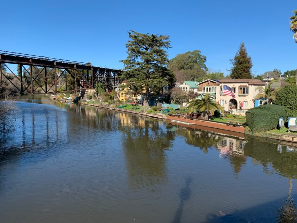
The view coming into Capitola via the railroad was stunning, in particular because it approaches the town from a cliff above the Soquel Creek, which it crosses by way of a 60-foot-tall, 120-foot-long trestle bridge. Crossing this bridge on foot was much more anxiety-inducing than the comparatively tiny bridge over the San Lorenzo River near the boardwalk. Falling from this height, I wouldn’t have to worry about the shame of a twisted ankle, I thought. This time, the fall into the shallow creek would have killed me. Luckily, there was a path on one side of the bridge where the boards were closer together than the awkwardly spaced railroad ties. However, I remained cautious because the boards were loose and creaky, and the gaps were wide enough to see the water below. Slowly, I made it to the other side and followed the railroad downward toward a road crossing, where I eagerly turned and headed into town.
I settled myself down at a quaint little ice cream and coffee shop and bought another black coffee for some energy, but also to have something to do. Here, I pulled out my phone for the first time and turned it on. I took a few moments to check an online map to assess my progress. Surprisingly, it was now about 1 p.m. and I had only walked a total of nearly 6 miles. This realization was demoralizing when I considered the already rough shape of my feet and the significant amount of pain they were causing me. I still had about 494 miles to go.
I walked to the nearby beachfront, where I found a secluded bench on which I could assess the damage done to my feet. When I slipped my boots off, I noticed even more bloodstains on my socks and some moderately sized holes starting to form where my bandages rubbed. I removed my old bandages to find slightly worsening blisters and sores, and even a few new ones. I cleaned up my wounds and applied new bandages, wondering how far my meager supply would get me.
I elected to take some more ibuprofen, wash it down with a few swigs of water, lace up my boots, and carry on. I had not yet realized the root cause of my pain, so I rejoined the railroad tracks just a few blocks from where I left them and started shuffling towards Aptos. I had several more hours of daylight, but well over 15 miles until my ultimate goal of sleeping on the beaches in Watsonville by nightfall.
As I trudged along the railroad corridor—my feet crowded and hot—I felt my small toe on my uphill foot rubbing against the next toe and causing a new blister. I tried focusing on the passing scenery, even if it was often just a long series of bushes or wild vegetation along the railway. I stared up at the sky to soak up the sun or gazed up into the occasional giant redwood or Monterey cypress that dotted the terrain. I
If I stayed in this little pocket of zen; the pain faded enough to make it four or five miles at a time before taking brief breaks, during which I would sit on my pack and rub my feet, or eat a spoonful of peanut butter.
Soon I was passing through the sleepy town of Aptos with its historic Victorian hotel and many dive bars. I crossed over a much smaller, much less remarkable trestle bridge when I arrived in town. The railroad corridor was decidedly more wooded and more reminiscent of the railroad higher up in the Santa Cruz Mountains. It followed a small, winding frontage road which itself followed along Highway 1. The population density was also much lower here; I was now going twenty or thirty minutes without seeing another human outside of a vehicle. This made me happy because I needed to make better time and I would have easily succumbed to any distraction in the way of conversation or a nice place to sit and have a coffee while checking my phone.
I mostly resisted the urge to check my phone to monitor my progress because I knew that the battery only held twelve or so hours’ worth of charge. Recharging it required an extended stay at a coffee shop, laundromat, or a similar public space. I had to time these prolonged pitstops carefully to coincide with times I had earned a break and also happened to be near civilization. Still, that digital map was the only way to tell how far I had gone in unfamiliar territory, and seeing that little blue dot inch ever closer towards a set goal was a necessary source of encouragement on that first day.
I also needed a means to record my journey for posterity, so I allowed myself to turn my phone on from time to time to snap a quick picture or record a short video diary. I did the latter while resting on my backpack somewhere outside of Aptos. I recapped my day to the camera, only making a minor note of the condition of my feet. I concluded the video with an optimistic cheerfulness. Inside, I was wondering how I was going to survive another 485 miles.
About an hour later, I arrived at La Selva Beach, where the railroad came right up to the ocean. Only a narrow, sandy pathway separated me from the soft warmth of the sand. I sat down, peeled off my boots, tied them together by their laces, and hung them around my neck. I grabbed my pack and slid down the embankment to the beach.
The sand enveloped my sore feet like a salve. The relief was instant. I wanted to walk barefoot along the beach for as long as I could stand it. It was a sunny afternoon, and there were more than a few folks in their bathing suits and summer attire enjoying this stretch of public beach. I was turning a few heads with my long corduroy pants and full hiking backpack, but I was too blissful in that moment of relief to feel self-conscious.
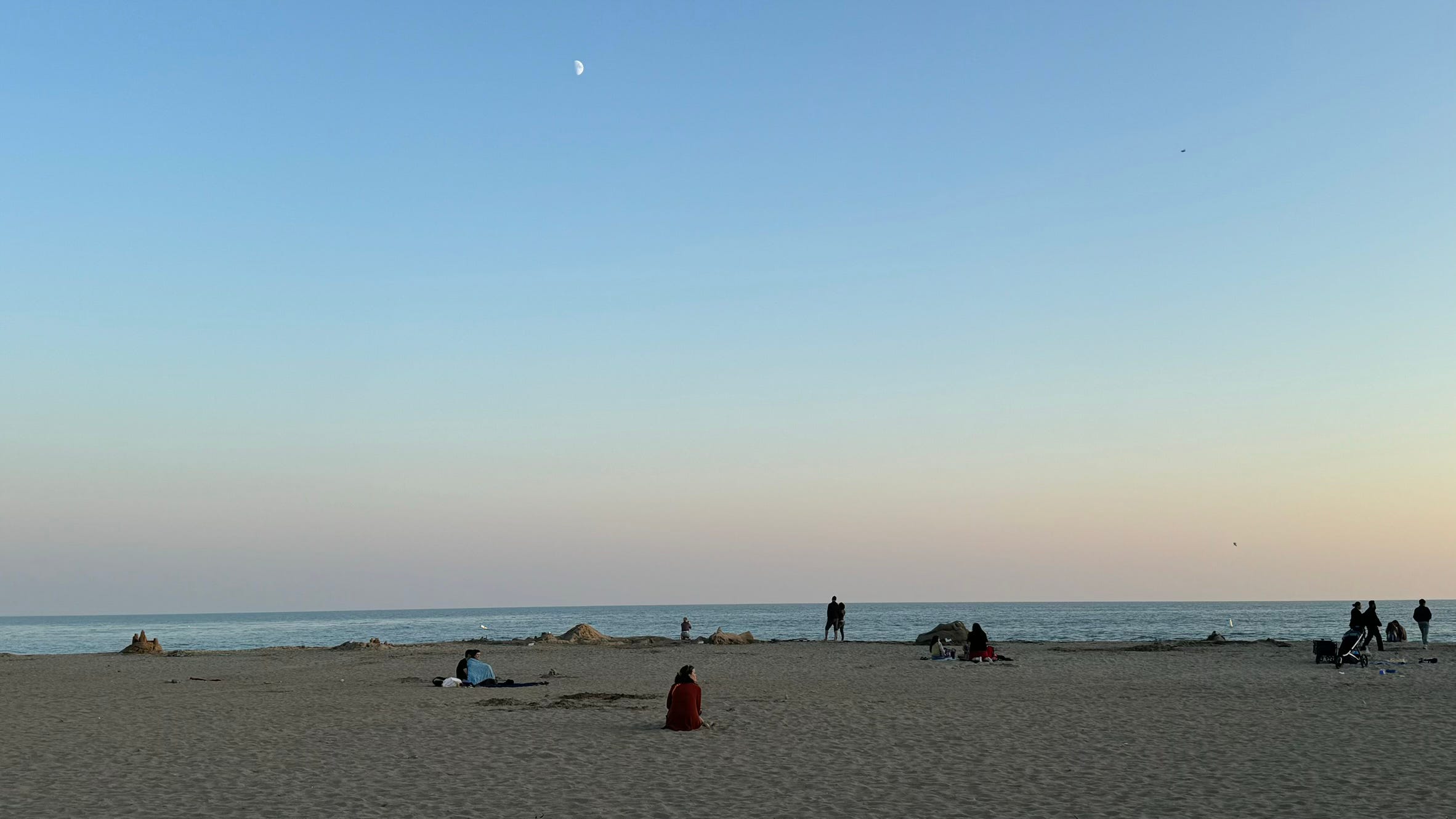
My joy lasted only a brief mile or so, until I realized how much more effort it takes to walk with a full backpack on sand. I was sinking a good one or two inches into the softness of the sand with every step. It took twice as much energy to push off of each foot, and I was already exhausted by it.
Reluctantly, I headed back towards the surface streets, dreading the iron maiden cage of my hiking boots. I spotted a flight of concrete stairs heading up to a public parking lot and a sign reading “Manresa Beach.”
In the parking lot, I rinsed my feet at a fixture designed for public foot rinsing and then dried them with my microfiber towel. Wincing, I pulled my already crusty wool socks over my raw feet and crammed them into my boots.
I found my way back to a main road and found that it followed more closely to the shoreline than the railroad tracks. I was now fully skeptical of the railway and its terrain. Following a more traditional road for a moment sounded like a worthwhile experiment.
San Andreas Road is a small, two-lane road that cuts through the coastal eucalyptus and opens up to a stretch of farmland. I had to stay close to dense foliage on the outer border of the narrow shoulder. The sun was getting low, so I elected to walk on the left side of the road. This made me more visible to cars, but also allowed me to see oncoming traffic instead of being surprised as vehicles whizzed by me from behind.
I walked for a few miles in this manner until it was nearly sundown. I walked past a sign for a small resort-like development that promised beach views. I passed million-dollar mansions and mobile homes. On my left, I passed a KOA and wished I had the means to stay there for the night, but I wasn’t nearly as far out of town as I wanted to be on my first day.
So, I plodded forward, staring at my feet and glancing up as vehicles came at me head-on. On these back roads, people tend to drive ten to twenty miles over the speed limit fueled solely on their familiarity with the road home and the tedium of having to drive the same street every day.
With my current state of low energy and expanded surface area given the size of my pack, I swayed a little whenever a vehicle flew by me. The larger the car, the bigger the wake of air as it whizzed by. I could see the faces of some of the drivers; some angry, some concerned, but most of them indifferent to the presence of a vagrant on their residential road.
I was still yet unwilling to give up on my plan to walk the beach from Watsonville to Moss Landing because—while it would be exhausting—it still cut out a few extra hours of walking inland. Just as that thought crossed my mind, the dense wooded area to my right opened up to a great expanse of farmland with a small sliver of visible ocean and beautiful sunset beyond.
As I trudged along, staring at the view to my right, the shoreline crept closer and closer to me, tempting me to try again. After another mile, I came to a long road which looked as if it promised to connect me back to the ocean. I decided to take my chances in the sand again.
Following this road—Sunset Beach Road—I passed along another tedious stretch of agricultural land, dilapidated shacks, and broken-down farming equipment. This time, however, the ocean loomed ahead of me as a beacon in the fading light. I walked into the parking lot for Sunset State Beach, passed the ranger’s station, and down a set of stairs onto the sand. The sun had already set, meaning all state parks and beaches were now technically closed. Further south from this parking lot, the beach became private property, accessible only to residents of a private resort. I needed to be a bit more cautious.
I elected to keep my boots on this time, hoping they would prevent me from sinking down so far into the sand. It proved to be a bit more economical this way—if not a bit worse for blisters than the railroad—and I continued on down the beach toward Pajaro Dunes. I was only a mile or so away from the Pajaro River estuary and discovering exactly what type of luck I would be having on this trip.
As I approached the resort, I saw several fires in the distance. I passed a few groups and tried to keep my head down. I very obviously didn’t belong, but I had no course of action but to pretend to belong for as long as possible.
I was able to skirt by unbothered until I neared the end of this stretch of beach. Approaching the much-anticipated Pajaro River estuary, there was a group of older men sitting around a fire, listening to music and drinking beer. There was a rocky cliff obscuring my view of the estuary and the group was close enough to the rocks that I couldn’t sneak by without coming awkwardly close.
I elected to tackle the situation head-on and ask them about the tides up ahead. At first, they didn’t seem to notice me over the music, so I walked closer and silently waved a greeting. One of the men turned to me slowly and lowered the music, apparently perturbed by the interruption. He didn’t speak, only acknowledged me by making eye contact.
“Sorry, I’m just walking through. I’m on my way to Marinas.”
“You mean Marina?” There were a few chuckles from the darkness on the other side of the bonfire.
“Yeah, sorry, that’s it. Do you know if the river is passable up ahead?”
“No, it’s high tide right now, buddy. You’re gonna have to go around,” they smiled at each other across the fire. “Nearest crossing is back up the road a ways,” he motioned towards the resort with his can of beer.
Great, I thought, that’s what I get for testing my luck. I sheepishly thanked them and headed up towards the resort development.
“Good luck with that.” The group laughed and turned the music back up.
I headed out from the resort down a long drive paralleling a small stream which joined the Pajaro River estuary. I could see that it was unfortunately brimming with water. Dejectedly, I shuffled down the drive, through an iron gate which was conveniently left wide open. My ego was thankful that I didn’t have to climb.
I checked the map on my phone and saw that the man wasn’t lying; I had another two or three miles before I would find a road that crossed the river. I didn’t know where this put me in terms of joining the highway heading south. It was getting late in the evening and I was too tired to untangle the digital web of roads on the other side of that bridge. I revised the day’s goal to simply crossing the river and finding a suitable place to lay down.
I walked a long, agricultural road populated only by nondescript outbuildings and dormant agricultural equipment. For the next hour or so I saw no one, not even a driver. My energy was plummeting, my stomach was empty, and my feet were killing me. A slow and steady shuffle forward was the most I could manage.
Soon, I came up on the only road in the area that turned right towards the Pajaro River—Thurwachter Road. I turned here, and after another half-mile I was crossing over the river and cursing its plentiful waters.
Only thirty or forty feet after crossing, I spotted a dirt path to my right which ran along a strawberry field and paralleled the flow of the river towards the ocean. To me, this seemed like as good a place as any to sleep. I walked down the path for a few hundred feet in order to be out of view of the road, and I set my pack down near some trees that lined the river embankment. I sat on my pack and ate some of the jerky, and as much peanut butter as I could stand. I removed my boots but elected to leave the old bandages on overnight; I had to conserve them for whatever was coming my way in the next 475 miles.
I pulled out my tarp and unraveled it, deciding I was too tired to do anything but roll myself into it like a burrito. Right before tucking myself into my sleeping bag, I realized I still had my food—which now included an open bag of jerky. I was feeling overly cautious, seeing as I was so close to the river’s edge—an area usually teeming with wildlife. I reluctantly put on my camp shoes and headlamp, took my bag of food and the roll of twine, and walked another hundred feet down the dirt trail. Using the twine, I hoisted the bag up into some branches and tied the loose end to a limb on a nearby tree.
I shuffled back to camp and slid into my sleeping bag on top of the tarp and rolled myself up into it. The night was cool and still. I could hear all manner of creatures rustling about in the tree line, and beyond that, the ocean waves crashing in the distance. I lay awake in my cocoon listening to the eerie sounds of the woods for at least another hour—my head full of dark thoughts about the first day, and the uncertainty of the days to come. I thought about my father and the heaviness that this particular day has always carried.
As my mind drifted between the woods and my dreams, I saw visions of my father on that bright August morning when he died. I saw his bed surrounded by ugly, sterile medical equipment but basked in warm, comfortable light. I vividly imagined the white sheets and white curtains, which then transformed into the white hair and shiny white teeth belonging to Bill Maupin. I had only ever seen his face in old newspapers, but I could see it now—as clear as day. I pictured Bill’s teeth grinning as he addressed his congregation with the news of my father’s death. I imagined my mother’s sad eyes as she read that letter from Bill which claimed that her family’s suffering was proof of the cult’s righteousness. As I finally drifted off to sleep, I realized that I had been walking towards the cult—towards Bill—my entire life.
Next week, we’ll keep moving into day two. I’ll pick up the narrative pace a bit now that I’ve set the scene. After that, we’ll explore the history of the cult and how my family got involved with it.
From now on, these essays will be for paid subscribers only. If you want to follow along and support my writing, please subscribe.
Thanks for reading,
Ben